Experimental Explorer

  • Home
  • Travel Tales
  • Itineraries
  • Photo Stories
  • Contact
Flamingo at sunrise

The orange orb slowly rose up from the waters, first showing only its crown and then gradually growing into the golden ball of fire that I was now admiring. I was still soaking in the beauty of hundreds of Coots swimming in the chilly early morning waters, trying very hard to resist the urge to jump in with them, when the Sun came out of nowhere and stole the show. I forgot all about the Coots and the urge to jump in, in a matter of seconds. Just as I was thinking “This can’t get any more beautiful”, the boatman did a quick maneuver and positioned the boat in front of a group of Flamingos, with their pinkish hue accentuated by the water glistening with reddish orange light, with the Sun in the backdrop. Thus started my day of birding at the Khumbargaon bird sanctuary in Bhigwan, near Pune.
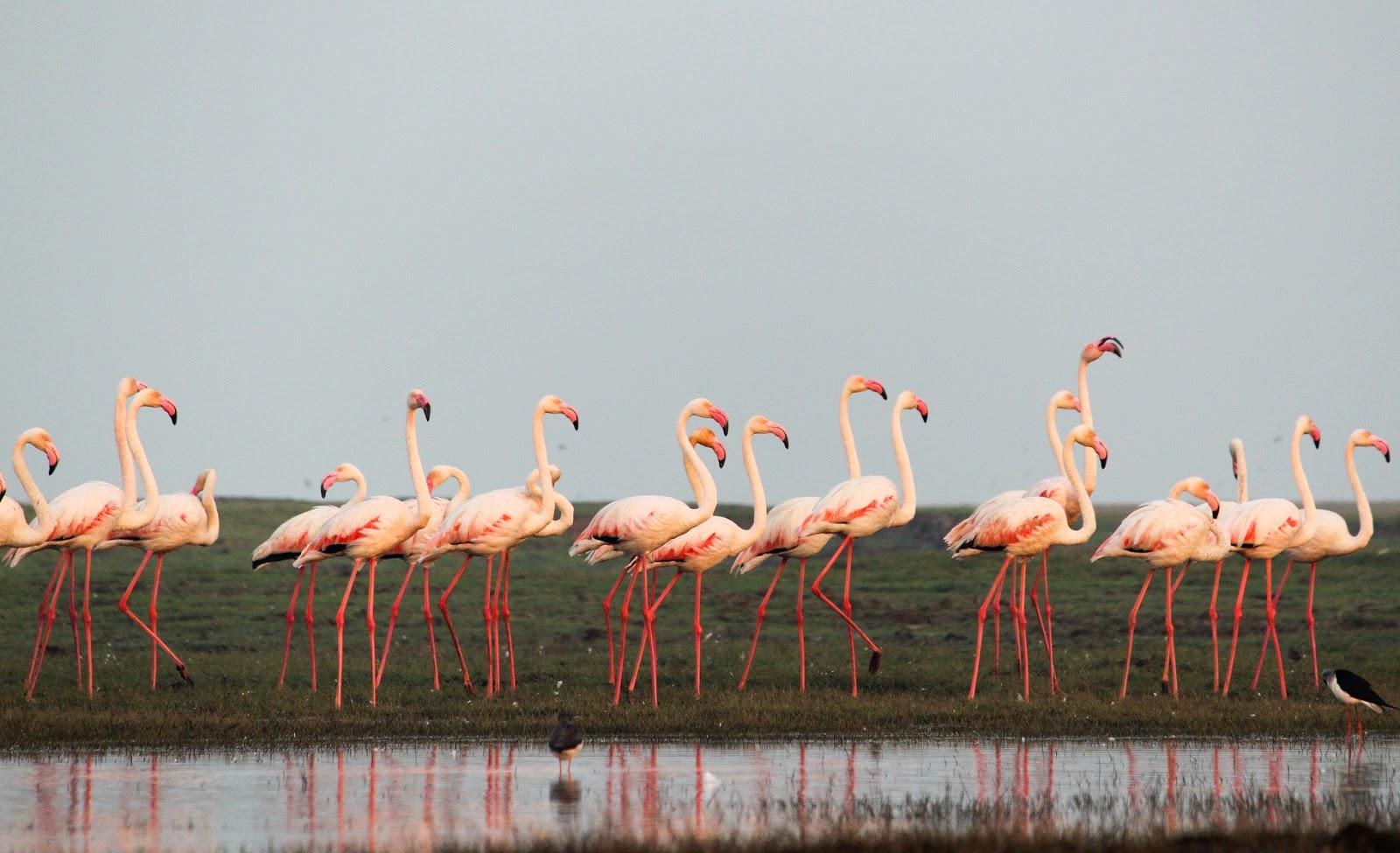
Flamingos at Bhigwan

I never stopped looking. The only reason the above scene disappeared from my sight was because, the boatman (who also acted as a guide) slowly steered away from it to other parts of the reservoir. And he did rightly so, because the reservoir is HUGE and has a lot more to offer. We were just getting started.

We slowly drifted through the waters along with numerous birds that were going through their morning routine. There were numerous others at the shores as well, each busy finding its morning food. Occasionally a Seagull zipping past above us would drop down to the water to get hold of a fish with laser sharp precision, and quickly soar back up again in a second. Unfortunately I’m only human and I could not move fast enough to capture the sight on my camera. So I did what I could, which was, to gape at it and wonder, “How the heck did you do that!”. I closed my mouth only when I was distracted by the boatman pointing me to a flock of Glossy Ibis flying at a distance.

Painted stork at Bhigwan

As we continued to move further in, I saw quite a few other varieties of birds - Spot-Billed Duck, Garganey, Shoveler, Cormorant to name a few. I saw so many in so much little time that I was left scrambling to remember their names as my guide went about naming them with ease. Thankfully I brought along a book of birds commonly spotted in the area, that helped me to quickly identify features and map their names. If you are a newbie like me going here, be sure to get a copy before heading into the waters.

Flamingo at Bhigwan
Awkward. If I have to choose just one single word to describe Flamingos, that would be it. Yeah well, if I could choose two words, I’d say ‘adorably awkward’. With their huge frame on slender, long legs, they might look awkward but at the same time beautiful and adorable. If you see one anywhere, make sure to stay put till it takes off, spreading out its pink wings - a sight to behold. Taking off from water, it looked almost as if it was walking on water. I have to admit, just watching them laze around de-stressed me.

Cormorant at Bhigwan

After wandering around in the water for a total of four hours, I reached the shore and stuffed my hungry self with exactly what the birds were eating, except, my fishes were cooked!

P.S: The birds that I’ve mentioned here is only a small subset of what is present at the sanctuary. I have published a full list of what I saw here.
Share
Tweet
Pin
Share
No comments
One of the less explored trekking trails of India, Dzukou valley, located at the border of Nagaland and Manipur, abundant with lush greenery, calm surroundings and a lavish spread of hills all around, is a visual treat for nature lovers. Here's a virtual peak into its sublime beauty.
After an arduous trek to the top drains all your energy, the initial views of the valley are all you need to get going again.

The only rest house at the top, to serve as your place of stay for the night. You can start seeing this a few kilometres before you actually reach it and from here on, the trail is either flat or slightly downhill.
Be sure to stay overnight and spend time exploring the valley, else you might miss some of the stunning views from inside the valley.
Settle down with some hot food, listening to your favourite songs, and watch the magic of earth rotating faster than it normally does.
Cross wooden bridges across pristine, ice-cold water. Close your eyes, and listen to the sound of nature.

Share
Tweet
Pin
Share
No comments
Having always wanted to explore more of the the North-Eastern part of India, the stories that I heard about the uniqueness of Dzukou valley and the tribal culture of Nagaland made me choose it as my next destination.


I flew from Hyderabad to Dimapur, the only airport and railhead in Nagaland. From the airport, I took an auto to Dimapur railway station, from where you will easily find shared Jeeps to Kohima. Now brace yourselves for a 3 hour long, tiring, bumpy ride on bad roads that will test your fitness and agility, after which you will reach Kohima, the capital city. It was almost sundown by the time I reached there, so I stayed there that night and headed towards a nearby village called Kigwema, the next day. If you are looking for luxurious hotels, Kohima is where you should stay put, because beyond it, in the villages, you will mostly find only basic homestays. I would suggest you to not spend too much time in Kohima and instead explore more of the villages because they are a lot more serene and peaceful.

Kigwema can act as your base camp for the trek to both Dzukou valley and Japfu peak. There are a handful of homestays available here. Unless you go during the peak season (winter/hornbill festival), you should be able to easily find rooms. I would highly recommend Akieno's homestay for their unbelievable hospitality. The heritage village, Kisama, which is also the site for Hornbill festival, is a short hike away from here. The heritage complex, showcasing the different tribes of Nagaland, their architecture and customs, is open all around the year, even when the festival is not on. There is also a museum (closed on Sundays) and a park inside the village.


I then headed to Dzukou valley, which was my primary motivation for the trip. There are two routes to Dzukou valley - the shorter but steeper route starts from Zakhama and the longer but easier route starts from Viswema. Both these places are reachable from Kigwema by a short taxi ride. I chose Zakhama since it was a lot closer to where I stayed, than Viswema. Both the routes are fairly simple and there is already a ton of information out there about the routes that, you can do the trek on your own, but if you are going solo, beware that this is a fairly lesser known trek and during off season you might find few people on the way. If you wish to, you may hire a guide from any of the surrounding villages. It took me about 4 hours to reach the rest house at the top. The temperature drops down rapidly as you go high, so go prepared with sufficient warm clothing and rain gear if you go around monsoon. While it is possible to return back the same day if you are fast enough and start early, I strongly recommend staying there overnight to explore the valley and not miss some of the unforgettable sights of the valley. The rest house has a couple of dormitories, a few rooms and a basic kitchen. I spent the remainder of the day and a good part of the next morning exploring the valley after which I trekked downhill, back again to Zakhama via the same route, and then took a taxi back to Kigwema.

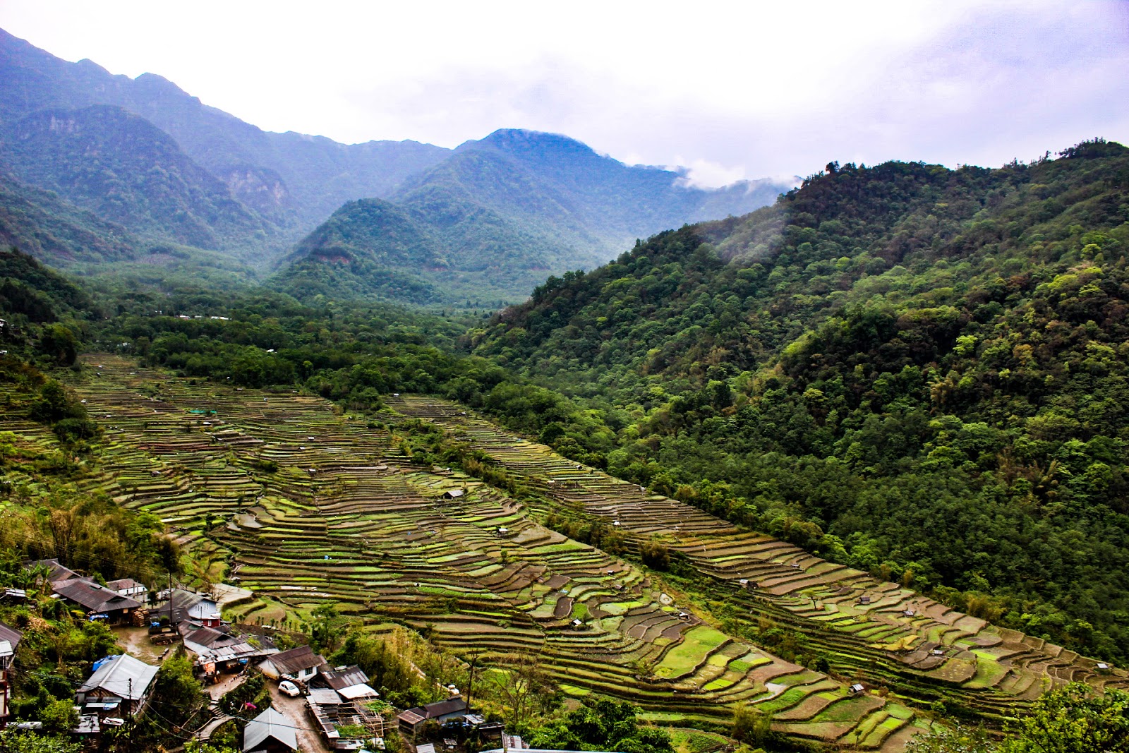
Due to unfavourable weather conditions, I skipped the trek to Japfu peak. My next stop was an Angami village, Khonoma. It is also known as the green village because hunting and cutting down trees are banned here. To reach Khonoma you first need to get to Kohima, and then from there it is an hour's drive by bus or taxi. With its magnificent paddy fields, intriguing architecture and greenery all around, taking a stroll around the village is a pleasant experience by itself, but hiring a guide is recommended if you wish to learn more about it. There is only one bus out of Khonoma, at 5.30 A.M. So, unless you have arranged for your own private vehicle, you need to stay there overnight and take the bus next morning to reach Kohima, which is what I did. While in Kohima, do visit the war memorial.

Paddy fields of Khonoma, the "green village"

My next plan was to visit Mon, in the northern part of Nagaland, where the Konyaks live. A bus from Kohima to Mon would take about 14 hours on bad roads, overnight. So I instead chose to go back to Dimapur, and take a train to Bhojo in Assam (the train would take 4-5 hours). From Bhojo take an auto to Sonari, and then you can take a taxi or a bus and reach Mon in 3 hours. I then went to an intriguing village called Longwa, half of which lies in India, and the other half in Myanmar. This is the only part of Nagaland where you can meet headhunters. Other attractions include the Angh's house, through which the international boundary line runs and the border pillar which gives a vantage point to both sides of the village. You can reach Longwa from Mon by a shared jeep, but the seats are limited and you need to book in advance.

Hills of Mon town in Nagaland at daybreak

To return back to Hyderabad, I did not want to go all the way back to Dimapur to take a flight, so I instead went to  Dibrugarh in Assam which is the closest airport to Mon. You can take a shared jeep from Mon to Sonari. Based on when you reach Sonari, you may or may not find a direct bus to Dibrugarh. I could not get one, so I took a bus to Moran, and then another one to Dibrugarh. It takes 3 hours to reach Sonari, and another 2.5 hours from there to Dibrugarh. The earliest public transport out of Mon is at 7 A.M (It may get further delayed based on how may seats fill up) and there is none on Sundays, so you may want to plan accordingly.

All domestic tourists need an Inner Line Permit to visit Nagaland, which can be obtained in person in Delhi, Kolkata, Guwahati, Shillong (you may need to check the official site for the latest list) or if you are unable to do so, you can get it done via a private tour operator by sending scanned copies of your ID.

Share
Tweet
Pin
Share
1 comments

When I decided to go to Parvati valley in December, everyone had the same question, “In winter?!?”. Coming from the land of always summer, I knew it would be difficult for me, but at the same time my longing for the big mountains was getting uncontrollable. So, I decided to break loose from the clutches of the city and run to that of the mountains.


Kheerganga view from the top


The one thing that anyone who has been to Parvati valley recommends is the Kheerganga trek, and I naturally wanted to do it too. It is an easy trek, would fit perfectly in my schedule, and the pictures looked brilliant. As fate would have it, it apparently shuts down for a week during winter when it snows heavily, and that week mostly falls in December. With an air of uncertainty surrounding my plans for the trek, I went ahead anyways. To make things worse in the meantime, a raid caused a closure of most homestays in the valley, which added even more to the uncertainty. Even after reaching Manali, I could not get concrete answers about the situation in the valley, leaving me in two minds about the trek, not to mention the mad rush that was coming in to celebrate the New Year.

With a few alternate plans in hand, along with a friend who had just joined me, and a couple of other co-travelers turned friends, I went on to the valley with hope. With sound guidance from like-minded folks, we found a place to stay at a base camp, a little-known village called Kalga, at the far end of the valley beyond Barshaini. And luckily, the trekking trail was open too. We took a taxi to reach Barshaini from Bhuntar, and then trekked to the village. There are also a couple of other villages a short trek away, like Pulga, Nakthan, which can also act as your base camp. As much clichéd as it may sound, the peace and serenity of the little-known hamlets are unbeatable in comparison to the well-known tourist hang outs in the Himalayas. You may have to barter your comfort in exchange, but you will definitely find it to be a fair deal. What you get in return is always so much more. Thinking back today, I’m not even sure if Kalga can be called a village because it was really just a few homestays and a couple of shops. But my stay here amidst towering snow-covered mountains, the warm smile of the little kid at the shop, the piping-hot food I had in freezing-cold moonlit night, are sure to stay in my memory for a long time to come.


Kheerganga view from base


Early the next day, we started our trek towards Kheerganga. Do you remember how I started this article by stating that this is a very easy trek? Well, I’d like to differ just a little bit here. The route is pretty simple and straight forward, the ascent involved is not too much, and the trail isn’t too long either. If you are just talking about the physical effort involved, it is an easy trek. But what made it a bit more than that, is the ice. It had snowed a few days back, and the trail was covered with extremely skiddy patches of ice towards the top. So, after a while, we literally had to watch our every single step. “Mountains, mountains, and more beautiful mountains everywhere, nor any eye to admire” because all the eyes are watching out for skiddy ice on the way!


Kheerganga trek view from camp


I don’t have to tell you how beautiful the end was, I’m sure the pictures stand testament to that. A lot many of the stays and shops were shut since it was off season, but there were sufficient options to cater to a normal turn out of travelers, ranging from dormitories with indoor heating, tents, to private rooms. That reminds me again of how lucky I was because on my way back the next day (which was the New Year’s Eve), I saw a humongous crowd heading towards the top. I still am not sure how so many people would have fit in on the top, or how much peace they would have got. I mean what is the point of taking the efforts to reach an unreachable place in search of some peace, only to find it as crowded as your hometown.

After an overnight stay in a tent, we left the next day after breakfast. The water was freezing cold, there was no hot water, and I was not prepared for this, and I will therefore not talk about how I brushed my teeth. Instead, I’d like to remind you of this brilliant invention called mouthwash and ask you to not make fun of its existence like I used to before, because Karma is like a rubber band. It was the same trail we took down as the one up. So again, all eyes were on the path. As with all treks, the climb down was much quicker, and we reached down for lunch.


Kheerganga trek

So, if you are planning a trip to Kheerganga in winter, I'd suggest you to go ahead. I'm glad I did :) 

Share
Tweet
Pin
Share
No comments
River ganga flowing through valleys of Himalayas in Uttarakhand

To just say that I’m not a fan of bus journeys, is an understatement. Trapped for long hours in a metal enclosure, sitting crammed in the same place amidst noisy people and the smell of fuel, is probably my least preferred mode of transport. I hate it so much so that, I’d rather travel in an airy, open lorry (Not that I’ve ever had the chance to, but still). However, the past few bus journeys that I took in the Himalayan region have made me change my views about bus journeys.

My first experience of a long bus travel in the Himalayan region was in Uttarakhand last year, when I travelled from Haridwar to Joshimath for more than 10 hours straight. The only means of connectivity to this place is by road and owing to the risk of landslides in this region, buses for this segment operate only during the day time. So, my last hope of managing the long journey by sleeping through it in an overnight-bus was also lost.

Bracing myself for what I thought would be an uneventful, restless journey, I got into a bus early in the morning at 5, from the bus depot at Haridwar. The first hour or so was indeed uneventful and boring but lo and behold, when the Sun began to rise, shedding its glorious light onto the charming Himalayas and the mighty Ganges, they took my breath away. From there on, things only went uphill, both metaphorically and literally. As the bus wound around the hills from the bottom to the top of the state, the Ganges and its tributaries constantly kept me company, caressing the mountains on either side as they did so. The sights were so beautiful that I was befuddled as to whether the mountains and the river were allies, working together to keep me entertained or were they rivals, each fighting the other for my attention? To make things more interesting en route, one can also witness the ‘Panch Prayag’ the confluence of the rivers, each with its own unique color splashing into one, before it officially becomes Ganga.

River ganga flowing through valleys of Himalayas in Uttarakhand

The above ‘more than great’ experience only made me all the more excited when I planned my next visit to the Himalayas, this time in Himachal Pradesh. When I had to take a bus from Shimla to Manali, I deliberately avoided a night bus, and instead booked a day bus, so I could enjoy going around the Himalayas yet again. It started with green, blue mountains, as far as my eyes could see, with the Sun playing its magic again, to make things more pleasant. With a gradual change in the colour of the mountains, it finally ended with white mighty peaks. If it was Ganga the last time, it was Beas this time, which was fighting it out with the mountains, confusing me yet again, as to what I should keep my eyes on.

When I finally reached my destination, I came to realize that for me, one of the best ways to experience the Himalayan region is to travel by road, with the Himalayas in my eyes, wind on my face, a camera in my hands, ARR on my ears, and well, potato chips in my mouth. These, most definitely, more than compensate for the bumpy long rides, crammed in a bus.
View of himalayan mountains from Manali

Share
Tweet
Pin
Share
No comments

The Elephant waterfalls, a broad, multi-tiered waterfall situated a short drive away from Shillong, the capital city of Meghalaya. It used to be called the Ka Kshaid Lai Pateng Khohsiew before it was renamed by the British as the Elephant falls.


Over here, people don’t build bridges, but grow them. A self-renewing, self-strengthening living root bridge that looks almost as if from a fantasy world.


To withstand the ruthless monsoon in this region, the innovative people of the Khasi tribe made these from living roots of rubber trees, to withstand the test of time for more than 100 years. I wonder how something as rudimentary to transportation as a bridge across a river, can be made so surreal.


Nokhalikai waterfall, making a plunge of about 340 metres makes the setting to click some pictures very pleasing, but the legends behind the name of the falls, not so much. According to the legends, a woman named Likai made a similar plunge from this cliff after she found out that her second husband had killed, cooked and fed her own daughter to her.


One of the many stops you can make while travelling through Meghalaya to get a glimpse of the the beauty the Khasi hills are. No wonder, the clouds wanted to make this place their abode. I'm glad I did too, even though just for a few days

Share
Tweet
Pin
Share
No comments

Rishikesh is known as either the spiritual capital or the adventure capital of India. For me, with zero interest in spirituality whatsoever, it is just the adventure capital. The thing about monsoons in Rishikesh is, all adventure activities shut down completely. So, when I had to pick a place around Dehradun to rest for a day after a tiring monsoon trek to the Valley of flowers, I was very skeptical about choosing Rishikesh. Nevertheless, I trusted my instincts and went there, and I have no regrets about it.

It was my second time in Rishikesh. I had already fallen in love with this place when I had visited it the first time a few months back, during peak season, when it quenched my thirst for adrenaline with rafting, bungee and more. Monsoon being off-season here, I did not expect much, and thought of mostly chilling indoors to give my legs some much needed rest. Yes, you guessed it right, then the monsoon magic happened, and my plan went for a toss, for good.

The gentle pours of rain lifted the charm of the Himalayas by leaps and bounds, making it more than difficult for me to not get out. I first headed to the Beatles ashram, hoping to enjoy the greenery of the nature trails. It turned out to be an absolute delight (yeah well, except for the mosquito menace). Chirping birds, colourful butterflies, calm surroundings and add to that a bit of quirky graffiti, it was a perfect spot to enjoy the monsoon. Then, there are always cafes overlooking the Ganges to unwind at, which is where I went next. Watching the pitter-patter on the river, while sipping a chocolate milkshake was the second-best way to enjoy the rains (My feet would say it was the best, but don’t listen to them, they were biased). 


Lastly, I went to the Neergarh waterfall that had swollen up due to the rains. Involving a small trek to get close to the waters, this one turned out to be a good call too.


The lush greenery, misty mountains, splashing waterfalls, and the post-rain calmness made me fall in love with Rishikesh all over again. Riding a bike around the hills with no particular destination in mind, I realized, there's more to Rishikesh than adventure, even for the non-spirituals like me.
Share
Tweet
Pin
Share
No comments
Older Posts

About me


About Me

Welcome to Experimental Explorer! My name is Kavipriya and I’m a travel and photography hobbyist. I will be sharing my travel experiences, stories, itineraries and photographs here. I mostly do solo, budget travels to quaint and serene places in India.

Follow Me

  • >
  • Instagram
  • <

Categories

  • national parks
  • northeast india
  • solo travels
  • treks

Popular Posts

  • Contact
  • Nagaland
  • The magic of Dzukou valley

All posts

  • ▼  2019 (1)
    • ▼  March (1)
      • Birding at Paradise
  • ►  2018 (4)
    • ►  September (1)
    • ►  May (1)
    • ►  January (2)
  • ►  2017 (7)
    • ►  December (7)
© COPYRIGHT 2017-2020 KAVIPRIYA ADHINARAYANAN | EXPERIMENTAL EXPLORER
All rights reserved. Unauthorized use of the contents of this page is strictly prohibited and is a punishable offence.

Created with by BeautyTemplates